Tekija
Tourism
Official Website: -
Website Introducing the Settlement: http://www.discoverserbia.org/sr/istocna-srbija/tekija
http://zlatnabucka.50webs.com/tekija.html
Cultural Tourism
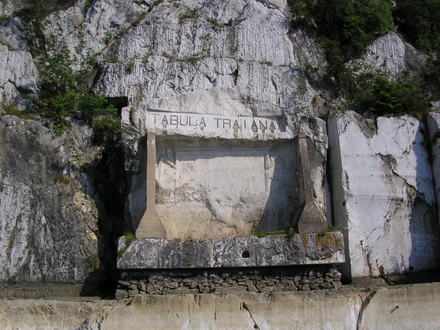
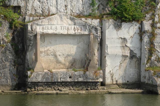
Traiana – Tabula Traiana: http://tovg.org/content/view/79/82/lang,serbian_lat/
Eco tourism, excursions
- National park
National park “Djerdap”: http://www.npdjerdap.org/en
Sports
"Golden bućka Đerdap" cultural and sports event: http://www.zlatnabucka.com/
Fishing on Danube -Tekija: http://zlatnabucka.50webs.com/ribolov.html
Đerdap Regatta Tekija-Kladovo-Kusjak - sport event: http://www.traveleastserbia.org/index.php?view=details&id=4%3A%C4_erdapska+regata+Tekija-Kladovo-Kusjak&option=com_eventlist&Itemid=1
Other Services
- doctor’s office
http://www.kladovo.org.rs/adresar/index.php.htm
- post office
http://www.nadji.info/mesto/39372/posta-tekija/
- tourist information bureau
Accomodation
http://www.zlatnabucka.com/index.php?option=com_content&view=article&id=17&Itemid=18
http://www.zlatnabucka.com/index.php?option=com_content&view=article&id=27&Itemid=27
Informations
|
|
Settlement name |
Tekija |
|
Population |
967 inhabitants |
|
|
Area (Kladovo municipality) |
629 km2 |
|
|
Administrative status |
village |
|
|
Location of settlement centre |
44° 41‘N, 22° 25‘E |
|
|
Height of settlement centre |
84 m |
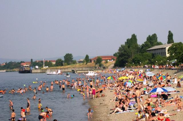
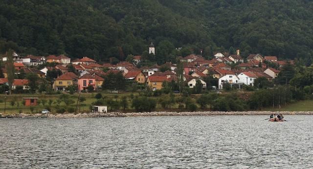
Tekija is a pleasant small place within Orsavska valley, and in order to achieve a lifting the Danube `s water level, it was built on the new location. In the past it was the residence of helmsmen who guided ships through the most dangerous parts of Djerdap George. At 957km is a confluence of Velika Kovila River as well as the bridge. Downstream from the bridge there is artificially made local beach, and on the river bank a partially arranged camp.
Tekija has several restaurants. In mid August a huge tourist event called Zlatna bucka of Djerdap, takes place and it is dedicated to the skill of large catfish fishing tools called Bucka. This event has its culinary and music programs.
Sipski canal today is just a memory on rocks rapids that even the best ship-builders and the most skillful captains failed to resist. In Roman era, they dug a long canal, and upstream navigating through it, the galleys were tugged by slaves. The Austro-Hungaria, on the Berlin Congress in 1878 was granted a mandate to execute hydro regulation of works. The mandate was transferred to the Hungarian Government, which engaged at that time, powerful machinery and large numbers of workers. The canal was solemnly inaugurated on 27th September 1896. It has 1843 m length and 80m width. The 3 m depth at the lowest water level facilitated a passage for larger river ships as well. Going through canal the ships were tugged by a tug Vaskap, and in 1916 Hungarians collocated and enabled the locomotive traction in the length of 1840m. Today the Sipski canal is located at the bottom of the Djerdap Lake which was created by the construction of the damn and hydro electric power plant. The navigation through this part of the Danube became easy and safe.
Source: www.wikipedia.org
Gallery