Tichileşti
Tourism
Official Website: http://www.ghidulprimariilor.ro/business.php/...TICHILESTI/29167,
Website Introducing the Settlement: http://www.ghidulprimariilor.ro/business.php/...TICHILESTI/29167, http://www.infozonemedia.eu/articole/eurocomuna-2/tichilesti-2
Other services
- police
http://br.politiaromana.ro/index.php?page=pol_br&opt=unitati
- post office
http://www.posta-romana.ro/offices/details/braila/tichilesti_3745
Informations
|
|
Settlement name |
Tichileşti |
|
Population |
4037 inhabitants |
|
|
Area |
63,48 km2 |
|
|
Administrative status |
commune |
|
|
Location of settlement centre |
45° 7’ 1” N, 27° 54’ 0”E |
|
|
Height of settlement centre |
4 m |
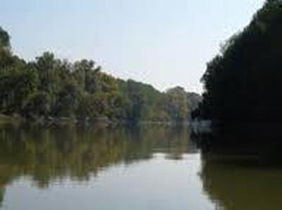
The Tichileşti commune is situated on the left bank of the Danube, on one side of the county road 212, at about 18 km from the capital county, city of Brăila, being composed of villages Tichileşti and Albina. The two localities of the commune are crossed from end to end, by two important roads, DJ 212 and 577, which provides excellent accessibility conditions.
It is not known with certainty when Tichileşti commune was founded, there are documents elaborated by over 200 years ago that reported for the first time the existence of the Tichileşti village on the same location as today. However, literature and local history known by the community elders say that the emergence of this settlement has its origins in much older times since the beginning of Ottoman rule in 1540.
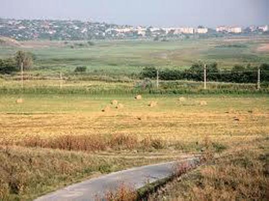
The Tichileşti commune has many opportunities for economic development and very favorable offer for agriculture. Villages of the commune, Tichileşti and Albina, have public utilities necessary for a normal environment: school, kindergarten, medical offices, shops, churches etc. Specific activities are agriculture area (vegetables), livestock and fisheries. Milling is practiced in the area, and the trade is achieved by various specialized stores.
Major tourist attractions within the village are the Church "St Voievodes", built in 1852, and the Danube River that allows fishing and leisure activities.
Source: http://www.ghidulprimariilor.ro/business.php/...TICHILESTI/29167 http://www.infozonemedia.eu/articole/eurocomuna-2/tichilesti-2
Gallery