Ciocanesti
Tourism
Official Website: http://www.primaria-ciocanesti.ro/
Website Introducing the Settlement: http://en.wikipedia.org/wiki/Comuna_Cioc%C4%83ne%C8%99ti,_C%C4%83l%C4%83ra%C8%99i
Cultural and Conference Tourism
- Monasteries, churches:
http://www.crestinortodox.ro/cauta/sfintirea-bisericii-sf-nicolae-ciocanesti-jud-calarasi
Ecotourism, excursions
- Ramsar sites, Natura 2000, Nature protection area:
Nature reserve islet Ciocanesti: http://www.looms.ro/calarasi/turism/atractii-turistice/parcuri-nationale/rezervatia-naturala-ostrovul-ciocanesti/
Gradistea Ulmilor: http://www.mdjcalarasi.ro/SITURI/GradisteaUlmilor.aspx
Other Services
- police
http://wikimapia.org/17593079/ro/Post-de-Politie-Ciocanesti
- pharmacy shop
- Bank
http://www.cautcredite.ro/sucursale-bancare/banca-c-r-firenze/Calarasi/ciocanesti/3000/; http://www.infostatistici.ro/statistici_bancare/16/pondere_sucursale_in_oras_ciocanesti/0/13/3000/
Informations
|
|
Settlement name |
Ciocanesti |
|
Population |
4,772 inhabitants |
|
|
Area |
131,12 km2 |
|
|
Administrative status |
Commune |
|
|
Location of settlement centre |
44° 12’ 0”N, 27° 4’ 59” E |
|
|
Height of settlement centre |
17 m |
The commune of Ciocanesti is located on the demarcation line between the southern border of Baragan Plain and the northern border of the Danube Meadow, between km 23 and km 30 on Calarasi – Oltenita road.
Opposite the commune of Ciocanesti, the Danube Meadow has an altitude of 12 m and a width of 5 km.
There are many sand banks and hillocks spread on a large area in the vicinity of Ciocanesti: Gradistea Ulmilor (Elm Hillock), where Boian – a prehistoric archaeological site – was discovered, Gradistea Mare (High Hillock), Crucea Mocanului (Shepherd’s Cross), Grindul Munteanului (Mountaineer’s Sandbank), which have all an altitude of 6 to 8 m above the meadow level. During floods, sand banks and hillocks become islands where animals and people take refuge.
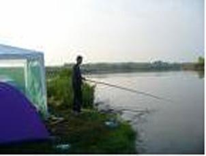
Fish breeding was started in Ciocanesti following the implementation of the Danube River embankment and land reclamation programme. A fishery has been created near Ciocanesti, on the eastern side of former Lake Bioan; it has a surface area of 170 ha.
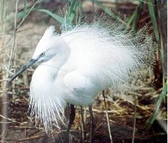
Tourist attractions. All those interested can study bird species, their behaviour in their natural environment and their particularities in the Ciocanesti Island Natural Reserve, a wonderful place where nature displays its beauty. The reserve is located on the Danube River and is part of Dunarica Production Unit I of Calarasi Forestry; it spreads on 206.7 ha and is 300 m long. The reserve is State property and is registered as included in the Danube flood plain. The reserve includes species of flora and fauna protected according to the Bonn and Bern conventions and similar.
Gallery