Vámosszabadi
Tourism
Official Website: http://www.vamosszabadi.hu/
Website Introducing the Settlement: http://hu.wikipedia.org/wiki/V%C3%A1mosszabadi
http://www.vendegvaro.hu/Vamosszabadi
http://www.iranymagyarorszag.hu/info/vamosszabadi/
Sport
- fishpond, lake
http://turaindex.hu/celpont/horgaszto181
Other Services
- doctor’s office
http://aranyoldalak.hu/vamosszabadi/orvosi-rendeles/index.mtt
- post office
http://www.vendegvaro.hu/Posta-Vamosszabadi
- restaurant
Informations
|
|
Settlement name |
Vámosszabadi |
|
Population |
1 536 inhabitants |
|
|
Area |
2 237 ha |
|
|
Administrative status |
village |
|
|
Location of settlement centre |
47.76670, 17.65000 |
|
|
Height of settlement centre |
112 m |

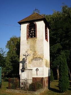
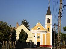
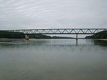
Vámosszabadi is located at a 10 km distance from Győr in northern direction along route 14. It has a bridge on the Danube and a border crossing point to the neighbouring Slovakia. It can be well accessed from Győr also by coach service. The settlement was founded about 990; it is mentioned in written form for the first time in 1268. It was established by the union of two villages: in the Middle Ages the settlement Alsóvámos was a customs point, whereas the settlement Győrszabadi kept in its name that its inhabitants had exemptions from certain feudal obligations. Vámosszabadi certainly had a church already in the 14th century that was destroyed later by the Turkish. The church, which is decorated by especially wonderful oil paintings and frescos, was rebuilt in the 20th century.
In the village four angler lakes can be found, which are frequently visited by the people living in the neighbourhood, the same refers to the local inn. Near to the dike of the Öreg-Duna (Old Danube) we can find the Vörösrét (Red Meadow), its moorish landscape ensures home for rare plant and animal species. We can see here among others black stork, grey heron, buzzard and marsh-harrier. We can make excursions also in the area of Körtvélylapos, in south-western direction from the village, where colourful seaweed associations are living in symbiosis. The Village House preserves primarily objects presenting the history and the everyday life of Vámosszabadi, but also religious relics may be found here.
Sources: http://www.vamosszabadi.hu/, http://hu.wikipedia.org/, http://www.vendegvaro.hu/
Gallery