Taksony
Tourism
Official Website: http://www.taksony.hu/
Website Introducing the Settlement: http://hu.wikipedia.org/wiki/Taksony_%28telep%C3%BCl%C3%A9s%29
http://www.vendegvaro.hu/Taksony
http://www.iranymagyarorszag.hu/info/taksony/
Health Tourism
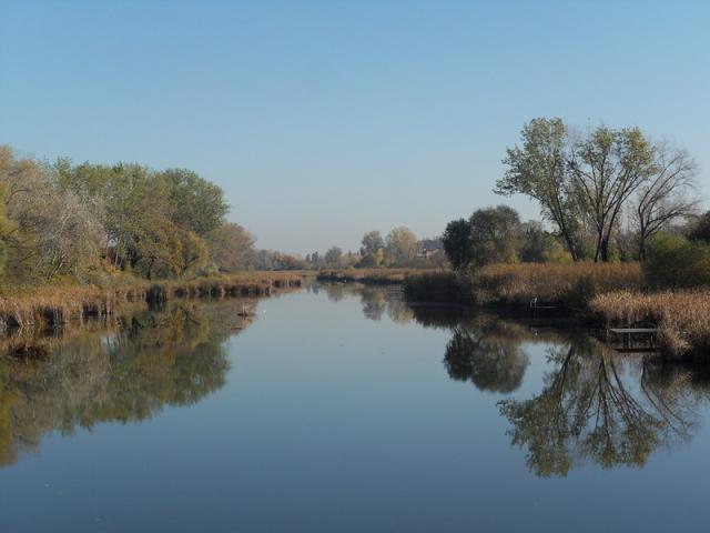
- beach (lakeside)
Rukkel Lake: (http://www.waterpark.hu/)
Cultural and Conferance Tourism
- heritage site (national importance), built heritage (local importance)
- permanent exhibition (local importance)
Tájház (country house): (http://www.museum.hu/museum/index_hu.php?ID=1555)
Sports
- fishpond, lake
Rukkel Lake: (http://www.waterpark.hu/)
Other Services
- pharmacy shop
http://www.vendegvaro.hu/Nadaskay-Gyogyszertar
- doctor’s office
http://www.taksony.hu/index.php?page=egeszsegugyi-intezmenyek
- post office
http://www.vendegvaro.hu/Posta-Taksony
- restaurant, café, pastry shop
http://www.cylex-tudakozo.hu/ceg-info/csengeri-cukr%C3%A1szda-82401.html
http://www.cegtudor.hu/ceginfo.aspx?id=10627
Accomodation
Informations
|
|
Settlement name |
Taksony |
|
Population |
6 291 inhabitants |
|
|
Area |
2 085 ha |
|
|
Administrative status |
large village |
|
|
Location of settlement centre |
47.33010, 19.06180 |
|
|
Height of settlement centre |
95- 105 m |

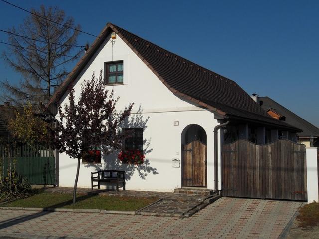
Taksony is situated at a distance of 20 km from the capital in southern direction. The village is a popular site for recreation, angling and paddling. The settlement can be approached from Budapest by rail or on route 510 the earliest. Through the bridge in the neighbourhood Csepel-island, within this Szigethalom and Szigetszentmiklós may be accessed. The village bears the name of ruler Taksony, who was the grandchild of ruler Árpád.
Due to the German settlement during the 18th century the village has considerable Swabian traditions. Besides the nationality folk-dance ensemble of Taksony – which is well-known all over the country - the German Nationality Folk Song Circle and Male Choir frequently have performances in the village. The village museum keeping the valuable traditions of the settlement was opened in 1994 with the contribution of the local Swabian community. The Petőfi Sándor Cultural House and Library pursues community activities.
The lake system located along the road connecting Taksony with Bugyi is famous of its fishes larger than usual. The angler-lake welcomes the visitors all the year, at which races are organized regularly. In Taksony’s high-standard sport centre with restaurant and event room besides sports (squash, fitness, aerobic, spinning) the organization of different events is possible. Although Taksony and its surroundings do not belong to the well-known hunting areas of the country, the area has excellent facilities. In the surrounding forests deer, pheasant, hare and wild-pig can be found.
Sources: http://www.taksony.hu/, http://hu.wikipedia.org/, http://www.vendegvaro.hu/, dr. Dusek László: Az Alföld. Cartographia, Budapest. 2000
Gallery