Pócsmegyer
Tourism
Official Website: http://www.pocsmegyer.hu/
Website Introducing the Settlement http://hu.wikipedia.org/wiki/P%C3%B3csmegyer
http://wiki.utikonyvem.hu/hu/index.php?title=P%C3%B3csmegyer
http://wiki.utikonyvem.hu/hu/index.php?title=P%C3%B3csmegyer
Cultural and Conferance Tourism
- heritage site (national importance), built heritage (local importance)
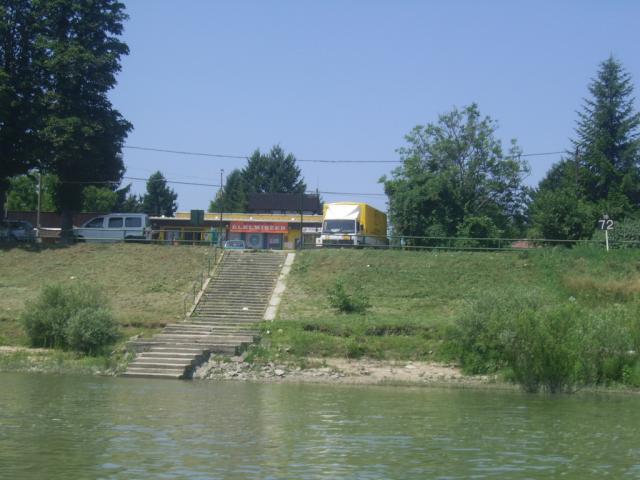
Water Tourism
- ferry
http://www.pocsmegyer.hu/menetrendek/rev.html
Sports
- certified riding school, horse farm
HSH riding farm: (http://www.hshlovarda.hu/)
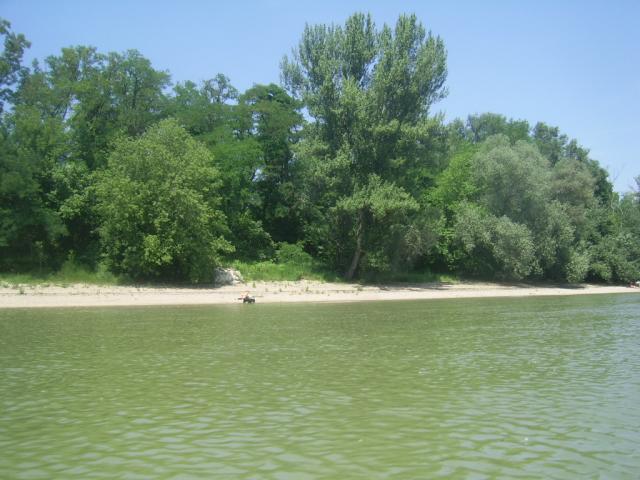
- fishpond, lake
Pázsit Lake: (http://pazsit-to.mlap.hu/)
Other Services
- pharmacy shop
http://www.pocsmegyer.hu/aktualis/gyogyszertarnyitva.html
http://www.koromvirag-gyogyszertar.hu/szent-klara-pocsmegyer
- doctor’s office
http://www.pocsmegyer.hu/intezmenyek/orvosi_rendelo.html?query=visegr%C3%A1d
- post office
http://www.mapinform.hu/city/pocsmegyer/1/
- e-point
http://www.emagyarorszag.hu/ugyfelkereso_reszletek.ivy?offid=B500D1F8-227F-427B-9F84-FDA1D3A8ED26
- restaurant, pastry shop
http://pocsmegyer.restaurnat.hu/
http://www.vevokkedvence.hu/ceginfo/julietta-cukraszda-bt-17798.html
Accomodation
Informations
|
|
Settlement name |
Pócsmegyer |
|
Population |
1 887 inhabitants |
|
|
Area |
1 308 ha |
|
|
Administrative status |
village |
|
|
Location of settlement centre |
47.71740, 19.09440 |
|
|
Height of settlement centre |
100-110 m |

Pócsmegyer and the resort area of the attached Surány are situated in the middle of the Szentendrei-island. We can approach the village through the bridge at Tahitótfalu or by the ferry at Leányfalu. From the Pest side of the Danube Pócsmegyer can be accessed by the ferry circulating between Göd and Horány. After the settling of the Hungarians this area was one of the quarters of the tribe Megyer. In the last centuries the location became a settlement serving the capital. Bread, fruits, vegetables and barn-door fowls were transported to Budapest by ship. Since the 1930s the drinking-water originating from the settlement ensures a significant part of the water base of the capital.
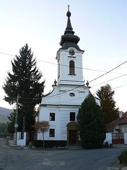
During our stay in the village the Calvinist church should be visited, which is in an especially good state. Also the surrounding of the baroque style building is well-ordered. The other monument of the settlement is the former Unger-Berczelly-curia, situated near to the ferry passing-place, behind the dike of the Danube. The Pázsit lake-beach is appropriate for bathing as well as for angling. At its shore the guests are welcome in the restaurant, who in case of interest can participate in programs like: horse- and archery show, folk-dance show, but they can order gipsy music, too. In the riding-school located in the Szigeti street riding courses are organized for children and adults. The farm has also show-jumping and dressage test tracks; during the mounted tours we can wander the entire Szentendrei-island.
Sources: http://www.dunakanyar.org/, http://www.vendegvaro.hu/, http://hu.wikipedia.org/, http://www.muemlekem.hu/
Gallery