Fajsz
Tourism
Official Website: http://www.fajsz.hu/
Website Introducing the Settlement: http://hu.wikipedia.org/wiki/Fajsz_%28telep%C3%BCl%C3%A9s%29
http://www.vendegvaro.hu/Fajsz, http://bacskiskun.hu/index.php/falvak-varosok-bemutatasa/727-fajsz
Other Services
- pharmacy shop
http://www.fajsz.hu/gss02/alpha?do=3&st=2&pg=6&m11_doc=918&m10_act=20
- doctor’s office
http://www.fajsz.hu/gss02/alpha?do=3&pg=6&st=2&m11_doc=26
- post office
http://www.dimo.hu/hu/cegek/51/Fajsz_Posta/Posta/Fajsz
- e-point, internet café
http://www.emagyarorszag.hu/ugyfelkereso_reszletek.ivy?offid=227A307A-D4E8-470A-BD59-8A7086EA72BB
- restaurant
http://www.cylex-tudakozo.hu/ceg-info/p%C3%A1lma-vend%C3%A9gl%C5%91---fajsz-84093.html
Accomodation
Informations
|
|
Settlement name |
Fajsz |
|
Population |
1 835 inhabitants |
|
|
Area |
3 199 ha |
|
|
Administrative status |
village |
|
|
Location of settlement centre |
46.41780, 18.91960 |
|
|
Height of settlement centre |
95 m |

Fajsz lies at the western boundary of Bács-Kiskun County, on the left bank of River Danube. It is to be found not far away from Road 51 and Szent László-híd (Saint Leslie Bridge) of Szekszárd. A ferry also takes you to the opposite bank of the Danube. The settlement does not have any railway station but it can be directly reached by Volán bus services from Baja, Kalocsa and Szekszárd, too.
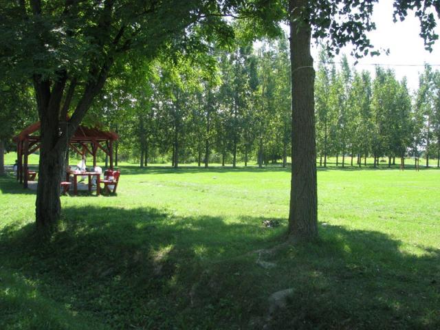
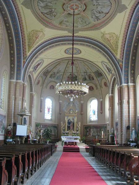
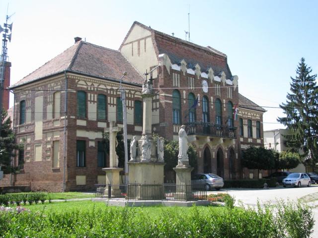
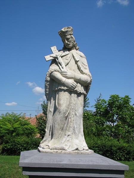
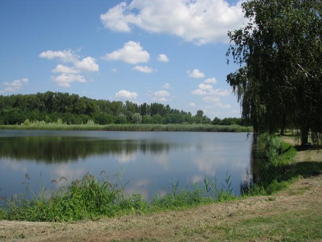
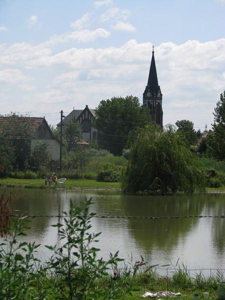
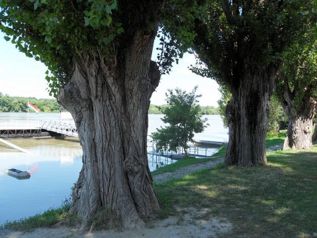
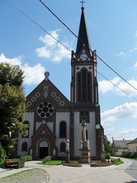
The village got its name after Prince Fajsz, the grandson of Chiftain Árpád, who had his camp in this region. In 1241 the settlement was burned up by the Tatars. In the 19th century three fires devastated in Fajsz; the chessboard-like street network of the village was developed in the course of the reconstruction works. The two most beautiful buildings of the settlement are the Roman Catholic church and the storied village hall. Both of them were built in neo-Gothic style; their harmony is a refreshing sight of the settlement. It is worth taking a look at the white marble statue in the square opposite to the village hall, representing the denominator of the village. The banks of the Danube in the village are favourite places for both bathers and anglers. The cycle track running on the embankment next to the river is part of the cycle track EuroVelo2000. Tired cyclists can take a rest in a wayhouse embraced by poplars.
Sources: http://www.fajsz.hu/, http://hu.wikipedia.org/, http://www.vendegvaro.hu/
Gallery