Budakalász
Tourism
Official Website: http://www.budakalsz.hu/
Website Introducing the Settlement: http://hu.wikipedia.org/wiki/Budakal%C3%A1sz, http://www.vendegvaro.hu/Budakalasz, http://www.dunakanyar.hu/terkep/6/Budakalasz.html
Cultural and Conferance Tourism
- heritage site (national importance),built heritage (local importance) http://www.muemlekem.hu/muemlek?egylapon=20&any=&nev=&helyseg_nev=Budakal%E1sz&cim=&torzssz=&id=&submit_text=Mehet&utolso-log-napok-min=
Water Tourism
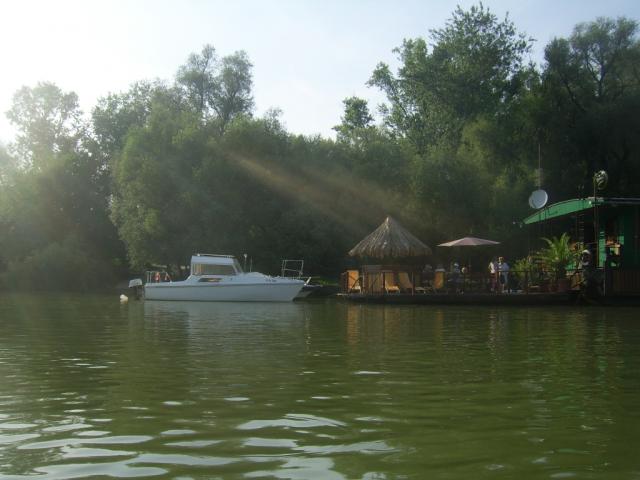
- wakeboard
Omszk Wakeboard Centrum (http://www.omszkwakecentrum.hu/)
Sports
- certified riding school, horse farm
Péntek Farm: (http://pentektanya.atw.hu/)
Other Services
- pharmacy shop
http://www.mapinform.hu/city/budakalasz/13/
- doctor’s office
http://www.budakalasz.hu/egeszsegugy/orvosok
- post office
http://www.mapinform.hu/city/budakalasz/1/
- restaurant
http://www.budakalasz.hu/idegenforgalom/vendeglato_helyek
Accomodation
Informations
|
|
Settlement name |
Budakalász |
|
Population |
10 499 inhabitants |
|
|
Area |
1 517 ha |
|
|
Administrative status |
város |
|
|
Location of settlement centre |
47.61950, 19.04700 |
|
|
Height of settlement centre |
100- 120 m |

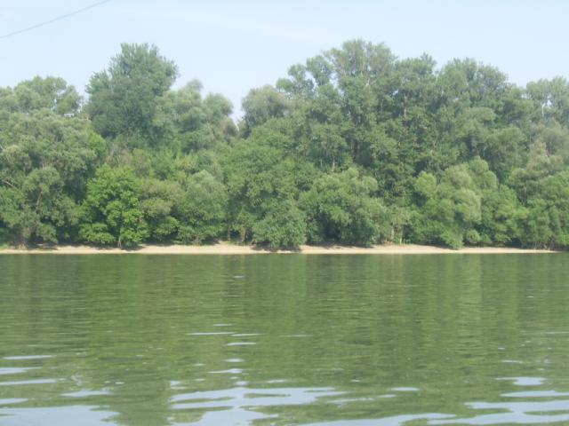
Budakalász is located on the right bank of River Danube, where the Danube Plain and three mountains, Pilis, Visegrád and Buda mountains meet. It can be approached by car on Road 11 or by the suburban railway or Volán bus service. In the neighbouring mountains there are a number of caves some of which can be visited. A marked (red) pathway leads to the lookout of the Nagy-Kevély hill towering in the western boundary of the town, from where a gorgeous view opens to the settlement and its neighbourhood.
The Luppa mining lakes to be found in the flood area of River Danube provide diverse possibilities for relaxation. Divers, surfers, jetskiers, anglers and bathers, too, are happy to visit the lakes. In the bathing season snack-counters also operate next to the lakes. You can find Omszki tó (Omsk Lake) not far away from the Luppa Lakes, near to Road 11, where there is a cable track exclusively developed for wake sports. The track includes elements (jumpers, sliding tubes) that make wakeboarding even more enjoyable. The tiny (800-metre-long) Luppa Island also lies within the public administration boundary of Budakalász, in the Szentendre branch of the Danube. The cottages of the quiet and cosy island can only be approached by boat.
The Village House of the town hosts musical, gastronomic and other events. The Local Historical Collection can be found at Budai utca 31, a residential house from the early 1900's. The church of the Serb minority represented by a large number of people was built in "Kárlóca" baroque style in 1752. The Greek Orthodox Church is located in the centre of the old village of Budakalász, Petőfi Square.
Sources: http://www.budakalasz.hu/, http://hu.wikipedia.org/, http://www.vendegvaro.hu/, http://www.omszkwakecentrum.hu/
Gallery