Kamenica nad Hronom
Tourism
Official Website: www.kamenicanadhronom.ocu.sk
Website Introducing the Settlement: http://sk.wikipedia.org/wiki/Kamenica_nad_Hronom
http://www.e-obce.sk/obec/kamenicanadhronom/kamenica-nad-hronom.html
Health Tourism
- Open air swimming pool:
Hotel Panoráma
http://www.hotelpanorama.eu.sk/sk/aktivity.html
Eco tourism, excursions
- Ramsar sites:
Ramsarská lokalita Dunajské luhy:
http://www.sopsr.sk/publikacie/ramsar.pdf
- Natura 2000:
Dunajské luhy
- Protected landscape and Nature protection area:
Chránená krajinná oblasť Dunajské luhy
http://www.sopsr.sk/index.php?page=posobnost&id=13
Nature protection areas – Burdov, Kamenický sprašový profil
http://uzemia.enviroportal.sk/
- Tourist path, nature trail:
Nature trails – Náučný chodník Kováčovské kopce - juh
http://www.naucnechodniky.sk/?id=2&c=ch&ch=18
Gastro tourism
- Wine region:
Južnoslovenská vinohradnícka oblasť
http://sk.wikipedia.org/wiki/Ju%C5%BEnoslovensk%C3%A1_vinohradn%C3%ADcka_oblas%C5%A5
Other Services
- post office
- restaurants, café, pastry shop
http://www.hotelpanorama.eu.sk/sk/restabar.html
Accomodation
http://www.hotelpanorama.eu.sk/sk/aktivity.html
http://www.1-2-3-ubytovanie.sk/ubytovanie/obec/kamenica-nad-hronom
Informations
|
|
Name: |
Kamenica nad Hronom |
|
Population: |
1363 |
|
|
Area: |
1871 ha |
|
|
Administrative status: |
village |
|
|
Location of settlement centre: |
47.495385, 18.432572 |
|
|
Height of settlement centre: |
132 |

Kamenica nad Hronom is a village in Slovakia in the district of Nové Zámky, located in the southeastern corner of the Danube plain. It lies 3 km northeast of Štúrovo. The village is easily accessible from Štúrovo with suburban services. The nearest railway station is in Štúrovo, 5 km away.
Finds of the Želiezovce and Lengyel Cultures, inhumation and cremation cemeteries prove settlement in the Neolithic, Aeneolithic, and Bronze Ages. The first reference to the village is from 1156. It was also mentioned in 1232 along with villages, which were adjudicated to Zvolen Castle, later it was owned by the Archbishop of Esztergom. The owner paid a lot of attention to the operation of the water mill existing in the village. The village was recognized in the past for its extensive vineyards producing an excellent red wine. Kamenica nad Hronom also belonged to Hungary in the years 1938 – 1945. The environs of the settlement were the scene of heavy fighting and a large part of it was demolished between December 1944 and March 1945.
The territory of Kamenice nad Hronom includes Kováčov, a recreation settlement located below the picturesque andesite rocks of Burda. It has gravel beaches, playgrounds, accommodation and catering amenities.
Northeast from the village extends Burda mountains. In 1966 364 ha of the mountains was proclaimed a nature reservation named Kováčovské kopce. It attracts the lovers of nature with its unique flora and fauna.
Sights:
- The railway station was built by the Austrian Society of State Railways in 1882.
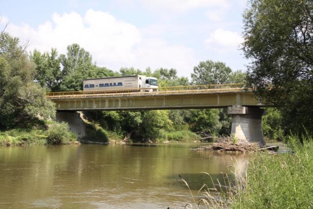
- The bridge over the Hron was in fact the biggest arched bridge in the Kingdom of Hungary, when it was built in 1907-1908. The Nazi troops blasted the bridge in 1945, the new bridge was built in 1961 on the surviving pillars.
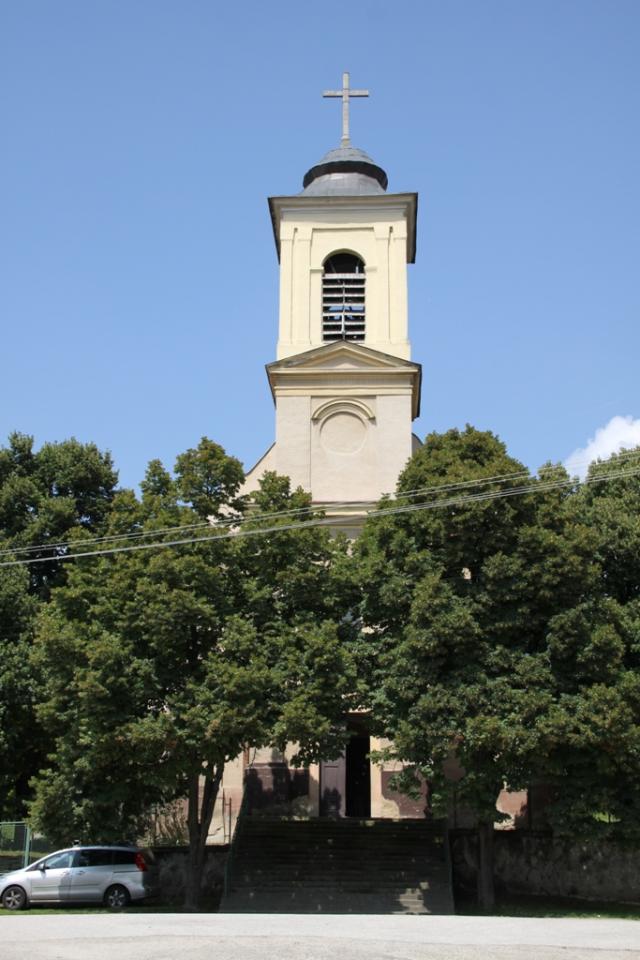
- The Neo-Classical, originally Baroque Roman Catholic church of St. Michael the Archangel is from 1734. A tower was added to it in the mid-19th century and later it was repaired.
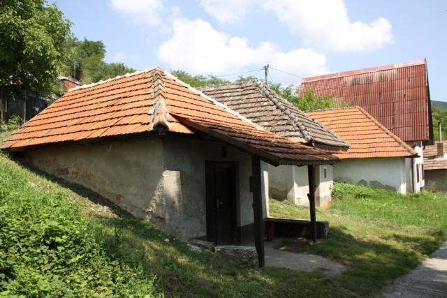
- The peculiarities of this village are wine cellars dug into the loess rock faces in its environs.
- The loess profile of Kamenica is registered as a protected natural phenomenon and it is a 5 to 15 m tall loess rock face on the southwestern slopes of Burda with nests of fowl.
There is a hotel, chalets, private accommodation, restaurant, pubs and food shops in the village.
Gallery