Neštin
Tourism
Official Website: -
Website Introducing the Settlement: http://en.wikipedia.org/wiki/Ne%C5%A1tin
Cultural Tourism
- Cultural and historical monuments
House plaiting: http://www.serbiatravelers.org/destinacije/vojvodina/3544-kuca-pletara-nestin
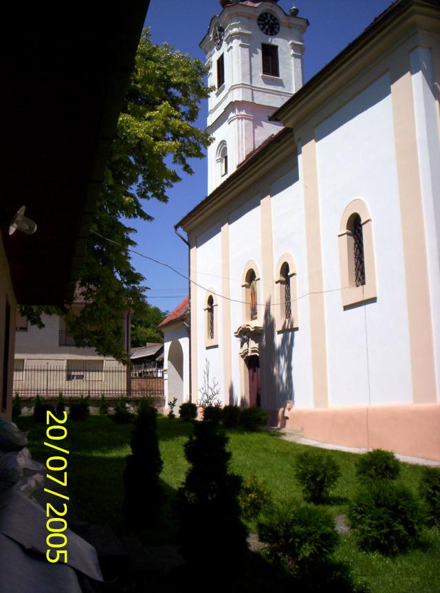
- Sacral monuments
The Orthodox Church of the Holy Kuzman and Damian in Nestin: http://www.pravoslavlje.nl/foto_crkve/crkva_nestin.htm
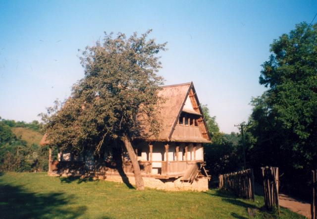
Eco tourism, excursions
Ethno house: http://www.vojvodinaonline.com/sr/detalji_gde.php?id=585&look=2
Neštin river picnic weekend: http://www.vikendodmor.com/test/Detaljnije_river%20picnic%20weekened_3.html
Neštin walking picnic weekend: http://www.vikendodmor.com/test/Detaljnije_walking_picnic%20weekened_3.html
Gastro tourism
Neštin gastro weekend: http://www.vikendodmor.com/test/Detaljnije_gastro%20weekened_3.html
Sports
Neštin fishing weekend: http://www.vikendodmor.com/test/Detaljnije_fishing_weekened_3.html
Neštin cyclo weekend: http://www.vikendodmor.com/test/Detaljnije_cyklo_weekened_3.html
Other Services
- doctor’s office
http://www.pttimenik.com/sr/bele-strane/347699/DOM-ZDRAVLJA-DR-MLADEN- STOJANOVI%C4%86
- post office
http://www.nadji.info/mesto/38583/posta-srbije/
Accomodation
Weekend house “Skelica”: http://www.skelica.com/
Vacation “Castellum” : http://www.castellums.info/
Informations
|
|
Settlement name |
Neštin |
|
Population |
900 inhabitants |
|
|
Area |
31,96 km2 |
|
|
Administrative status |
village |
|
|
Location of settlement centre |
45° 14‘N, 19° 27‘E |
|
|
Height of settlement centre |
79 m |
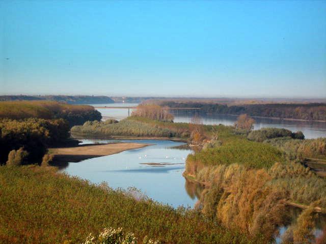
Neštin is located on the Northern slope of the last Western part of Fruška gora at the point of meeting of the lower broad part of velley Jakov Dol and the Danube. The settlement Neštin is located in the last Northern part of terrain of near the Danube valley. Good position of traffic – geografical spot is conditioned by direct link of the settlement to the road that leads through the Danube line , from Ilok, over Neštin, Susek, Beočin to Novi Sad and from that goes in the way of the regional and the main road. Territory of Neštin comprises 5,5 3% of the surface of the Municipality. Tha means that Neštin belongs to the group of smaller settlements. The territory of Neštin has the irregular shape with the longer line in direction of NNW and lenght 23 km.
The soil structure in Neštin shows relatively suitable preconditions for flora.In the shallow places there are meadow species with high plants with chaparral and shrub, and in the higher places there is grain grow and industrial plants. Specifical relevant natural factors were the preconditions for the vineyards growt (72, 66ha) and fruit growt (58,97ha) comparing to other parts of the Municipality .Besides, there is important role of many secondary factors, such as tradition, growing of vine and fruit next to the resting houses , but there is also manufacturing, specialy in the vine growt.
The remains of material culture (weapon and money) that directly near Neštin there were human settlements in Latene era ei. 500 Bc. The proves of existed settlement to the East from Ilok , near nowdays Neštin, is linked to Roman rule. Under the present name was mentioned in 15th century when it was representing a part of defensive system of the fortification against the Turks. During the Turkish rule (16th and 17th century) the settlement was not mentioned in historical sources. It was mentioning countinuously from 1734 as a settlement of 132 houses. The houses in Neštin are low , with one floor and moslty built „Na brazdu“ or by the road. The older houses were built of adobe and covered with cane and newer are modern made of contemporery materials , distinguishing from the older houses as the city homes.
Some of the institutions in Neštin are – four grade Primary school, Serbian Orthodox church, the posto office and ambulance service.
Source: www.wikipedia.org
Gallery